


la mole

le.noceur
User
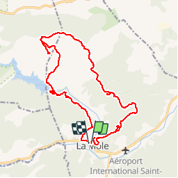

Length
21 km

Max alt
357 m

Uphill gradient
615 m
Km-Effort
29 km

Min alt
26 m

Downhill gradient
616 m
Boucle
Yes
Creation date :
2014-12-10 00:00:00.0
Updated on :
2014-12-10 00:00:00.0
5h22
Difficulty : Very difficult

FREE GPS app for hiking
 SityTrail
IGN / Geographical institutes
SityTrail Plus
The world is yours!
About
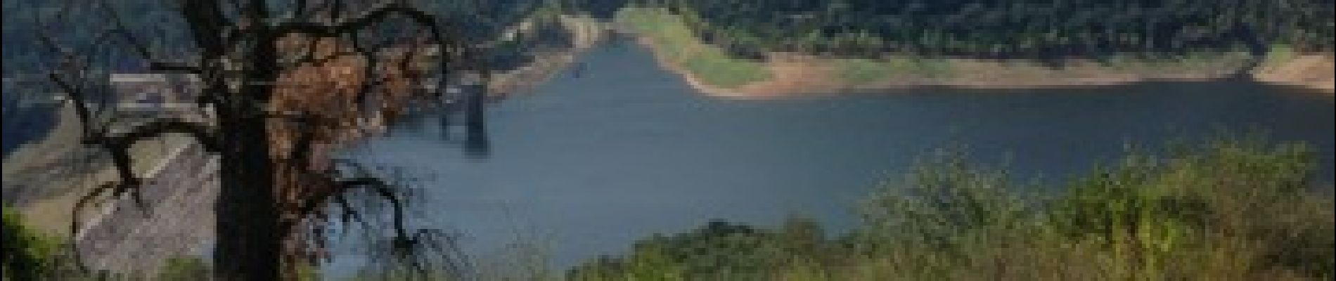
Trail Walking of 21 km to be discovered at Provence-Alpes-Côte d'Azur, Var, La Môle. This trail is proposed by le.noceur.
Photos

Positioning
Country:
France
Region :
Provence-Alpes-Côte d'Azur
Department/Province :
Var
Municipality :
La Môle
Location:
Unknown
Start:(Dec)
Start:(UTM)
294053 ; 4787072 (32T) N.
Comments